Seal Coat Project: 2017
Zone: North, SouthWhat zone am I?
Completed
Start: May 2017
Estimated Completion: Fall 2017
Project Overview:
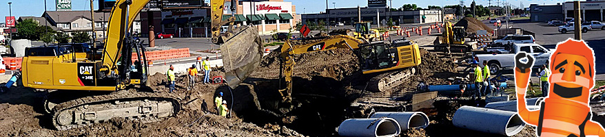
This project is part of the city’s annual infrastructure improvement efforts and impacts multiple areas of Fargo each construction season. Seal coat projects extend the life of asphalt pavement and provide a more traffic and weather resistant surface. It involves spraying an asphalt emulsion on the pavement surface, immediately followed by a rock chip application that is embedded into the emulsion. The project will be take place in 13 different areas.
Impacts:
Traffic will be maintained during construction, but some lanes may be closed at times or parking temporarily reduced for work being done. This work will be performed on streets and avenues in these areas of the city:
Section 1:
- 10th Street N from 31st Avenue N to 32nd Avenue N
- 9 ½ Street N from 10th Street N to 32nd Avenue N
Section 2:
- 14th Avenue N from Oak Street N to 3rd Street N
Section 3:
- Elm Street N from 11th Avenue N to 12th Avenue N
- Oak Street N from 7th Avenue N to 11th Avenue N
- 2nd Street N from 9th Avenue N to 12th Avenue N
- 3rd Street N from 9th Avenue N to 12th Avenue N
- Broadway N from 9th Avenue N to 12th Avenue N
- 9th Avenue N from 1st Street N to Broadway N
- 10th Avenue N from 1st Street N to Broadway N
- 11th Avenue N from Elm Street N to Oak Street N
- 11th Avenue N from 1st Street N to 4th Street N
- 12th Avenue N from Elm Street N east to bridge over the Red River
Section 4:
- 2nd Street S from Main Avenue to 4th Street S
Section 5:
- 7th Street S from 5th Avenue S to 9th Avenue S
- 8th Street S from 5th Avenue S to 9th Avenue S
- 11th Street S from 2nd Avenue S to 5th Avenue S
- 12th Street S from 3rd Avenue S to 4th Avenue S
- 3rd Avenue S from 10th Street S to University Drive S
- 4th Avenue S from 10th Street S to University Drive S
Section 6:
- 33rd Street S from 13th Avenue S to 15th Avenue S
- 34th Street S from 13th Avenue S to 35th Street S
- 35th Street S from 14th Avenue S to Prairiewood Circle S
- 14th Avenue S from 32nd Street S to 35th Street S
- 15th Avenue S from 32nd Street S to 35th Street S
- 16th Avenue S from 32nd Street S to 34th Street S
- Prairiewood Circle S from 35th Street S to Prairiewood Drive S
Section 7:
- 47th Street S from 16th Avenue S to 17th Avenue S
- 48th Street S from 13th Avenue S to 16th Avenue S
- 49th Street S from 17th Avenue S to 21st Avenue S
- 50th Street S from 13th Avenue S to 15th Avenue S
- 50th Street S from 17th Avenue S to 21st Avenue S
- 51st Street S from 16th Avenue S to 17th Avenue S
- 52nd Street S from 17th Avenue S to 21st Avenue S
- Cul-de-sacs west of 51st Street South.
- 14 Avenue S from 48th Street S to 50th Street S
- 15th Avenue S from 45th Street S to 50th Street S
- 16th Avenue S from 45th Street S to 48th Street S
- 17th Avenue S from 45th Street S to Fargo/West Fargo boundary
- 19th Avenue S from about 442’ east of 49th Street S to Fargo/West Fargo boundary
- 21st Avenue S from 49th Street S to 52nd Street S
Section 8:
- Park Drive S North of 21st Avenue S
- 21st Avenue S from 5th Street S to University Drive S
Section 9:
- 28th Street S from 36th Avenue S to 40th Avenue S
- 32nd Street S from 32nd Avenue S to 38th Avenue S
- 33rd Street S from 32nd Avenue S to 37 ½ Avenue S
- 33rd Avenue S from 32nd Street S to 33rd Street S
- 35th Avenue S from 32nd Street S to 36th Street S
- 35 ½ Court Avenue S from 32nd Street S to 33rd Street S
- 36th Avenue S from 25th Street S to 33rd Street S
- 37th Avenue S from 28th Street S to 33rd Street S
- 37 ½ Avenue S from 28th Street S to 33rd Street S
- 38th Avenue S from 25th Street S to 36th Street S
- 38 ½ Avenue S from 25th Street S to 38th Avenue S
- 39th Avenue S from 25th Street S to 39 ½ Avenue S
- 39 ½ Avenue S from 25th Street S to 39th Avenue S
Section 10:
- 58th Street S from Osgood Parkway S to Beach Lane S
- 63rd Street S from 40th Avenue S to Osgood Parkway S
- 65th Street S from 45th Avenue S to Fargo/West Fargo boundary
- 66th Street S from 40th Avenue S to 45th Avenue S
- Beach Lane S west of 58th Street S
- Lee Lane S between Beach Lane S
- Clubhouse Drive S from Osgood Parkway S to 263’ south of Houkom Court S
- Houkom Court S from Osgood Parkway S to Clubhouse Drive S
- Cul-de-sac S of Osgood Parkway S
- Furnberg Place S south of Osgood Parkway S
- 44th Avenue S from Veterans Boulevard to 58th Street S
- Christianson Parkway S from 66th Street S to 45th Avenue S
- 45th Avenue S from 65th Street S to 66th Street S
Section 11:
- 11th Street S from 54th Avenue S to 55th Avenue S
- 12th Street S from 54th Avenue S to 55th Avenue S
- 54th Avenue S from 11th Street S to University Drive S
- 55th Avenue S from 11th Street S to 12th Street S
Section 12:
- 14th Street S from 55th Avenue S to 57th Avenue S
- 15th Street S from 55th Avenue S to 58th Avenue S
- 16th Street S from 55th Avenue S to 57th Avenue S
- 18th Street S from 52nd Avenue S to 58th Avenue S
- 19th Street S from the cul-de-sac north of 56th Avenue S to 57th Avenue S
- 20th Street S from 52nd Avenue S to 58th Avenue S
- 20th Street Circle S from 19th Street S to 57th Avenue S
- 53rd Avenue S east of 20th Street S
- 54th Avenue S east of 20th Street S
- 55th Avenue S east of 20th Street S
- 55th Avenue S from 14th Street S to 16th Street S
- 56th Avenue S from 18th Street S to Bishops Boulevard S
- 57th Avenue S from 14th Street S to 20th Street S
Section 13:
- Bennett Court S east of 21st Street S
- 22nd Street S south of 61st Avenue S
- 23rd Street S from 60th Avenue S to 63rd Avenue S
- 24th Street S from 57th Avenue S to 63rd Avenue S
- 57th Avenue S from Bishops Boulevard S to 24th Street S
- 59th Avenue S from 21st Street S to 24th Street S
- 60th Avenue S from 21st Street S to 25th Street S
- 61st Avenue S from 21st Street S to 22nd Street S
- 62nd Avenue S from halfway between 22nd Street S and 23rd Street S to 25th Street S
- 63rd Avenue S from 23rd Street S to 24th Street S
Timeline:
Construction will begin in late April/early May and continue throughout the season, when contractors can fit work into their schedules with other projects. All seal coat improvements should be complete by fall.
Purpose:
Installation of a seal coat at this time will extend the life of these roadways considerably.
Funding:
This project is estimated to cost $1 million. It will be paid by street rehabilitation funds and special assessments. Property owners is sections 10 and 13 above should receive special assessments.
A typical road will experience three seal coat applications throughout its lifespan, applied approximately every eight years to asphalt pavement. The first seal coat application is funded through 100% special assessments while the remaining projects are 100% city funded.
Here is the typical timeline for this preventive maintenance:
- Road built/reconstructed – Wear Course (top layer of the asphalt)
- Year 2 – Seal Coat (100% assessed) applied
- Year 10 – Seal Coat (100% city funded) applied
- Year 18 – Seal Coat (100% city funded) or Mill & Overlay depending on roadway conditions
- Year 25 – Mill & Overlay (50% assessed/50% city funded)